Here are key facts about Tana River County, location, sub counties, constituencies, wards, people, attractions, Tana River, climate and many more.
Tana River County is among the 47 counties in Kenya. The county name was obtained from the popular Tana River traversing across the county.
Quick Overview Of Tana River County
Tana River County is among the 6 counties in the Coastal regions lying between Latitudes 000’53’’ and 200’41’ South and Longitudes 38025’43’’ and 40015’ East. The county borders Kilifi County in the South, Lamu County in South East, Isiolo County in the North, Garissa County in the North East, and Kitui County in the West.
Tana River County gained its name from the River Tana. The county covers 35,375.8 Square Kilometers. The county is divided into 3 Sub Counties, 3 constituencies, and 15 wards. Its main town is Hola or sometimes called Galole.
Tana River County has an orderly government encompassing County Executives and County Assembly according to the Kenyan Constitution 2010 documented under Acts176(1). The leadership is driven by its vision “To be the leading Assembly in the Republic in ensuring accountable, equitable and effective delivery for the people” and quality value for the good of the people.
Tana River Constituencies
There are three constituencies namely;
- Galole Constituency
- Garsen Constituency
- Bura Constituency
Tana River Sub Counties
The sub conties are divided into three such as;
- Tana North Sub County
- Tana Delta Sub County
- Tana River Sub County
Each sub county is further divided into wards. The total number of Tana River wards are 15 Wards. Tana North Sub County has six wards, Tana delta Sub County has five wards and Tana River Sub County has four wards.
1. Tana North Sub County Wards
- Sala Ward
- Bangal Ward
- Chewele Ward
- Madogo Ward
- Hirimani Ward
2. Tana Delta Sub County Wards
- Kipini West
- Kipini East
- Garsen South
- Garsen Central
- Garsen North
3. Tana River Sub County Wards
- Mikinduni Ward
- Chewani ward
- Wayu Ward
- Kinakomba ward
Tana River Tribes
Some of the tribes in Tana River County include;
- Pokomo
- Gadsan
- Orma
- Wardey
- Dagodie
- Sheekhal
Tana River Geography And Climate
The county experiences mostly dry seasons throughout the Year. The temperature ranges mostly from 30- 33 degrees Celsius with minimal annual relief rainfall. The rainy seasons come between March to May and October to December.
However, due to lack of water catchment areas, the rain causes floods, and only a few places are suitable for crop farming.
Tana River County Attraction Sites
Although the county is located in a semi-arid area, its economic status has been boosted by tourism. Tana River county boasts of having several tourist attractions centers that are widely spread across the county. Asa result most of the locals have ventured into hotel and hospitality service provision.
The sites have improved trade, attracting both local and international investors. Kenyans from other counties have relocated to Tana River county’s strategic areas in search of greener pastures or pursuit of their career. Some of the popular Tana River County attractions include;
1. River Tana Delta
The delta is among Kenya’s Larges freshwater wetlands that provide the locals with grazing areas and is a habitation of the wildlife. Several tree species and small water lives have been preserved from extinction.
2. Kora National Park
The park is located near Kora Rapids, Adamson’s Falls, George Adamson’s Grave, and Rand fall.
3. Tana Delta Dunes
The Delta has beautiful sandy dunes at the shows of the Ufungamana bay. The place has several lodges to accommodate the visitors as they enjoy the panoramic view of the wild beach and the lush vegetation around and the river.
4. Hola Monument
The monument is an erected structure in loving memory of 11 Mau Mau fighters who were massacred after being imprisoned in the Tana River region.
5. Bura Irrigation Scheme
The scheme is located in Lowa Tana, South of the Equator on the western side of River Tana. The irrigation scheme was designed by the World Bank’s executive board members to facilitate crop plantation throughout the Year to sustain the natives with enough food supply.
6. George Adamson Bridge
The Bridge walk back in the days of George Adamson. It is long across the river; however, it is not safe as several crocodiles come out to bask in the sun. Visitors are therefore cautioned to be extra careful.
7. Tana Primate Reserve
The reserve was established to protect the endangered monkey species known as the colobus and the Mangabey. The Mangabey is a special type of monkey with Yellow- Brown far and white eyelids. The reserve was developed in 1976 when people migrated near the water source and endangered the monkeys’ lives.
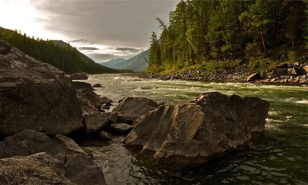
8. Tana River
Tana River is the longest river in Kenya, with a length of 100,000Km. The Tana River County gained its current name from the River Tana. The river has its main tributary as Thika River, which flows from the Aberdare Mountains, Mt. Kenya, between Meru and Kitui, Bisanadi, Kora, and Rabole National Reserves. It enters Garissa town to the River Delta into the Indian Ocean via Hola / Garsen.
Tana River has been used to establish several Dams and reservoirs, namely
- Masinga Dam,
- Kamburu Dam,
- Kiambere Dam,
- Kindaruma Dam,
- Kiambere Kamsinga Reservoir.
These water projects help supply water to the Kenyan Communities for agricultural and domestic purposes. Moreover, the country has engaged in modern technology to generate Hydro- Electric Power. The power plants serve almost all the nation with electricity for domestic and industrial needs.